Planning a Safe Multi-Day Spring Hike in the Cascades

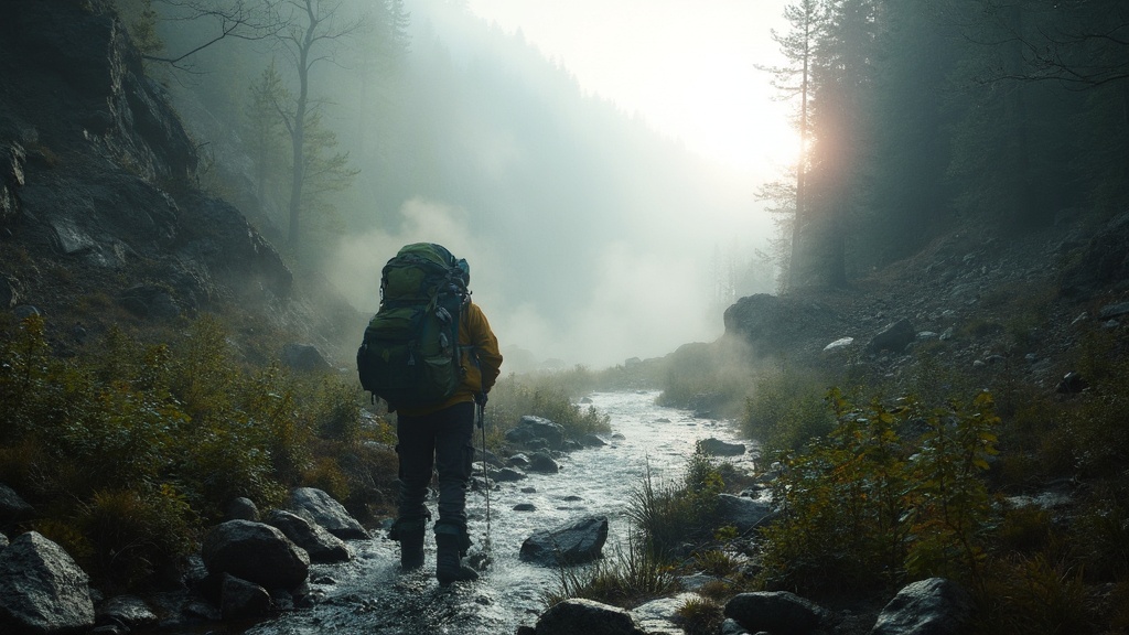
Ever set out on a spring weekend trek in the Cascades only to watch a swollen creek turn your campsite into a river? That sudden rush can ruin a trip, waste gear, and even land you in a rescue call. The good news? With a handful of data sources and a disciplined prep routine, you can out‑smart the melt and make it to the summit safely.
What are the biggest spring hazards in the Cascades?
Spring in the Cascades is a mixed‑bag of rapid snowmelt, early‑season rain, and still‑snowy high passes. The three hazards that bite most hikers are:
- Washouts and flash‑flooded creek crossings. A dry‑season stream can become a torrent overnight.
- Unstable snowpack. Ice bridges can collapse, and avalanche danger spikes.
- Permit bottlenecks and parking shortages. Early‑spring demand spikes before the crowds settle into summer.
Understanding each threat in real time is the first line of defense.
How can I use real‑time data to avoid washouts?
All the data you need lives online for free. Follow this workflow:
- Check the USGS Water Data Service. Look up the current discharge for the North Fork Snoqualmie. If the flow exceeds 250 cfs, plan a detour.
- Monitor the National Weather Service (NWS) flash‑flood outlook. The NWS issues polygon alerts that update every hour.
- Subscribe to the Cascades Trail Washout Discord bot. It aggregates the USGS feed and pushes a "Washout Alert" to your phone.
- Cross‑reference with my recent post Cascades Trail Washouts March 2026 for proven detour routes.
When the numbers look risky, skip the crossing and use the real‑time data dodge guide for alternate trailheads.
Which permits and parking spots stay open in early spring?
The Washington Trailhead Pass Matrix (see my Pass Matrix guide) shows that the North Cascades Highway permits open on Tuesdays and Thursdays, while the Mount Baker trailheads close after 10 am on weekdays.
- Parking hacks: Arrive before 7 am at the Baker Lake lot for a guaranteed spot.
- Reserve early: Use the Recreation.gov calendar to lock in a permit at least 48 hours ahead.
If you miss the window, the Trail Condition Data Comparison post helps you find secondary entry points.
What gear and food strategy keeps me safe on a multi‑day spring trek?
Spring weather swings from 30 °F night lows to 70 °F daytime highs. Pack for the worst while staying light:
- Insulated, breathable layers. Merino base, fleece mid, waterproof shell.
- Water treatment. Carry a portable UV purifier and a chemical tablet backup.
- Food calories. Aim for 2,800 kcal per day; freeze‑dry meals with a lightweight stove.
Don’t forget a microspike for icy ascents – see my Traction Protocol for the right choice.
What’s the step‑by‑step itinerary planning workflow?
Follow this checklist the night before you head out:
- Open the USFS avalanche forecast for your region.
- Pull the latest USGS creek flow numbers for every crossing on your route.
- Confirm your permit status on Recreation.gov.
- Mark detour options in Google Earth (or my Permit Clock spreadsheet).
- Pack gear according to the Spring Safety Checklist below.
Spring Safety Checklist
- ✅ Check avalanche & washout data.
- ✅ Verify permit & parking.
- ✅ Pack layered clothing, microspikes, UV purifier.
- ✅ Load emergency beacon and extra batteries.
- ✅ Share itinerary with a trusted contact.
Takeaway: Your Spring Multi‑Day Blueprint
By marrying real‑time hydrology data, official permit calendars, and a disciplined gear list, you can turn a risky spring window into a reliable adventure. The next time you stare at a rising creek on the trail, you’ll already have a detour plotted and a permit secured—no panic, just progress.
Got a favorite spring route? Drop it in the comments and let’s add it to the Pre‑Dawn Safety Audit map.