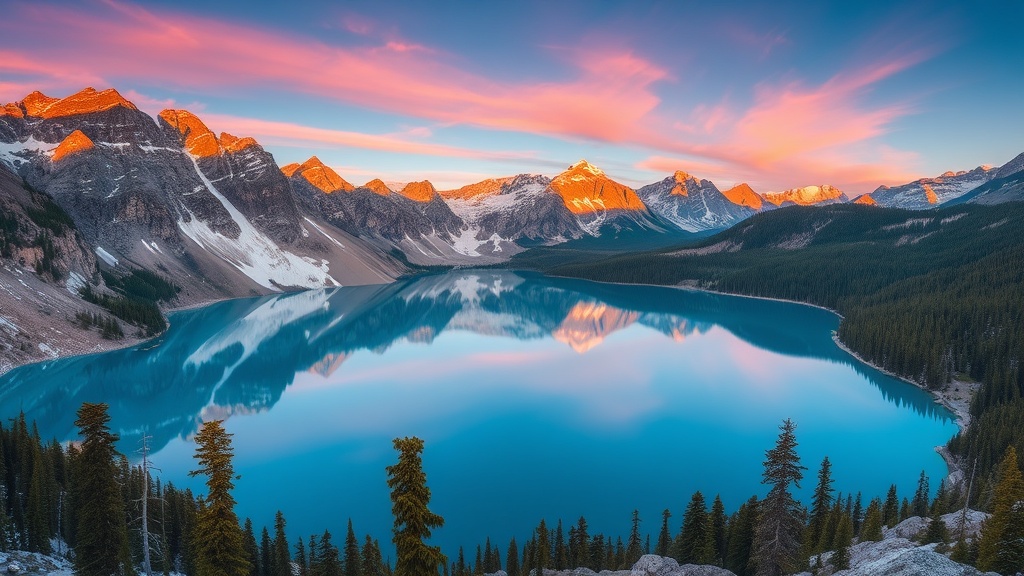
Hidden Alpine Lakes: 5 Breathtaking Hikes Off the Beaten Path

This post breaks down five alpine lakes in the Cascades that don't show up on Instagram's trending page—locations where water temperatures stay glacial year-round, trails demand real fitness, and crowds thin out after the first mile. You'll get precise distances, elevation profiles, hazard warnings, and gear recommendations based on actual field conditions. These aren't the sanitised trail descriptions that send unprepared hikers into sketchy terrain.
What Makes an Alpine Lake Hike Truly "Hidden"?
A hidden alpine lake sits at least three miles from the nearest paved road, lacks amenities like toilets or signed junctions, and sees fewer than twenty hikers on an average summer weekend. The Cascades hide dozens of these gems—most require bushwhacking, creek crossings, or route-finding skills that filter out casual visitors.
The five lakes in this guide share common traits: no cell service, no maintained campgrounds, and approaches that demand respect for mountain weather. That said, each offers something distinct—glacial cirques, trout fishing, or solitary swimming holes where the water hits 48°F even in August.
Where Are the Best Hidden Alpine Lakes in the North Cascades?
The best hidden alpine lakes cluster in the Glacier Peak Wilderness and the Pasayten Wilderness—areas where trailheads require high-clearance vehicles and trail maintenance runs years behind schedule.
Lake Doe (Glacier Peak Wilderness, Washington)
Distance: 7.2 miles round trip | Elevation Gain: 3,100 feet | Difficulty: Strenuous
Lake Doe sits in a granite cirque beneath Labyrinth Mountain, fed by snowmelt that keeps it turquoise through September. The trail starts at the Trinity Trailhead—your Subaru won't make it; you'll need something with 8+ inches of clearance for the final two miles of Forest Service Road 4901.
The first three miles follow an abandoned logging road that's slowly reverting to forest. Here's the thing: blowdowns from the 2022 windstorm still block the tread in three places. Bring a folding saw (the Silky F180 handles 6-inch diameter logs cleanly) or plan on losing thirty minutes to scrambling.
At mile 3.4, the route leaves the old road and climbs 1,200 vertical feet in 0.8 miles. This section isn't maintained—cairns mark the way, but they're easy to miss in fog. The lake itself sits at 5,800 feet, surrounded by heather meadows that bloom crimson in late July. Water temperature: 46°F. Swimming is possible for about ninety seconds before numbness forces retreat.
Hazards: Loose talus on the final approach. Snowfields persist into early July. Creek crossings become dangerous during thunderstorms—check the NOAA North Cascades forecast before leaving the trailhead.
Blue Lake (Ptarmigan Traverse Access)
Distance: 9.4 miles round trip | Elevation Gain: 2,400 feet | Difficulty: Moderate to Strenuous
Not the crowded Blue Lake off Highway 20—this one's a feeder route for the Ptarmigan Traverse, accessed from the Cascade River Road. The trail sees heavy use from mountaineers heading toward Cache Col, but day hikers rarely venture past the 4-mile mark where the views open up.
The approach follows an old mining track through second-growth forest before switchbacking through subalpine fir. Worth noting: the trail crosses three avalanche chutes that retain snow well into August. Microspikes help even in summer—the snow gets hardpacked and slick.
The lake itself is long and narrow, dammed by a moraine that makes for easy walking along the east shore. Cutthroat trout run small but abundant; a Patagonia Black Sonic 3-weight and elk hair caddis will keep you busy for hours. Camping options are limited—sites exist on the north end, but the ground's rocky and you'll need to hang food properly (black bears know this spot).
Which Alpine Lakes in the Cascades Are Safe for Beginners?
Beginners should stick to lakes under 6 miles round trip with less than 2,000 feet of elevation gain, maintained trails, and established campsites. Only one lake on this list qualifies—Hidden Lake Lookout near the Mountain Loop Highway.
Hidden Lake Lookout (Mount Baker-Snoqualmie National Forest)
Distance: 5.6 miles round trip | Elevation Gain: 1,400 feet | Difficulty: Moderate
This one's the exception—well-maintained tread, signed junctions, and a historic fire lookout you can rent overnight. The trail climbs steadily through old-growth hemlock before breaking into meadows with views of Glacier Peak. The lake itself is small, shallow, and warms to swimmable temperatures by late August.
The catch? Parking. The trailhead holds maybe fifteen vehicles and fills by 7 AM on summer weekends. Arrive early or hike in from the alternative start at the Squire Creek Campground (adds 2.4 miles each way). The lookout books out six months in advance through Recreation.gov—worth it for the sunrise views, but bring earplugs (the wind hits that ridge hard).
Copper Lake (Entiat Mountains)
Distance: 11.2 miles round trip | Elevation Gain: 3,600 feet | Difficulty: Very Strenuous
Copper Lake separates serious hikers from weekend walkers. The trail starts low in ponderosa pine forest and doesn't let up—3,600 vertical feet with no flats, no switchbacks that feel easy, and a final mile that gains 800 feet through loose scree. Most parties take seven to eight hours round trip.
The reward? A deep lake with water so clear you can watch cutthroat cruising forty feet down. The cirque walls rise 1,500 feet on three sides. Snowmelt feeds a waterfall on the north shore that's loud enough to mask conversation. It's spectacular. It's also serious country.
Route-finding challenges start at mile 4.5 where a 2021 landslide wiped out fifty feet of tread. Cairns mark a scramble route through the debris, but it's exposed—wet boots slide on the clay. Trekking poles are mandatory here, not optional. The Black Diamond Trail Cork Pro handles the lateral loads better than collapsible carbon poles.
What Gear Do You Actually Need for Alpine Lake Hiking?
You need layered clothing that handles temperature swings, footwear with aggressive tread for talus and snow, and water purification because giardia lives in even the clearest alpine streams.
| Item | Lake Doe | Blue Lake | Hidden Lake | Copper Lake |
|---|---|---|---|---|
| Footwear | Mid-cut boots (ankle support for talus) | Trail runners OK | Trail runners OK | Stiff-soled boots (scree protection) |
| Traction | Microspikes (snow into July) | Microspikes recommended | Not needed | Crampons if early season |
| Water carries | 3+ litres (no sources after mile 2) | 2 litres (frequent streams) | 2 litres | 4+ litres (long dry stretches) |
| Bugs | Bad in July (bring headnet) | Moderate | Light | Minimal (too high, too windy) |
| GPS/Gaia file | Recommended (faint tread) | Helpful for off-trail exploring | Not needed | Essential (slide area confusing) |
The gear list stays consistent across all five lakes: a shelter layer even for day hikes (mountain storms build fast), sun protection (UV reflects hard off water and snow), and the ten essentials packed with actual competence—not just checked boxes. That means a headlamp with fresh batteries, not the dim one from your glovebox. Fire starter that works when wet. A first-aid kit with blister pads and gauze for the scrapes you'll collect on talus.
Lake Elu (Alpine Lakes Wilderness)
Distance: 13.4 miles round trip | Elevation Gain: 4,200 feet | Difficulty: Very Strenuous
Lake Elu represents the upper limit of what's reasonable for a motivated day hike—most parties backpack in. The approach follows the Pratt Lake trail for six miles before branching onto a climber's path that sees maintenance once every few years. It's steep, rooty, and crosses Pratt Creek twice (knee-deep in early season, ankle-deep by September).
The lake sits in a glacial bowl below Granite Mountain, surrounded by slabs that attract rock climbers and sunbathers alike. Water entry requires commitment—the shoreline drops off fast, and that turquoise colour comes from rock flour suspended in near-freezing meltwater. Staying in longer than five minutes risks cold shock.
Campsites are plentiful but exposed. The alpine zone means no fires allowed—bring a stove. Bears aren't a major issue here (too high, too little food), but rodents will chew through ultralight shelters for the salt in your sweat. Store food in a hard-sided canister or hang properly using the PCT method at least twelve feet up.
Weather windows matter more at Lake Elu than the others. The cirque collects afternoon thunderstorms that roll up from the Snoqualmie Pass corridor. Lightning risk is real—there's no tree cover above 5,500 feet. Start early, be below treeline by 2 PM, and watch the western horizon for building cumulus.
"The Cascades don't care about your timeline. Turn around when the weather turns, when your gut says no, or when you're moving slower than planned. The lakes will be there next weekend. You need to be too."
These five lakes reward preparation and punish overconfidence. The trails aren't dangerous by objective standards—they're just honest. Bad fitness, poor navigation skills, or inadequate gear turn moderate routes into serious undertakings. Check your ego at the trailhead, pack for conditions not forecasts, and verify that your insurance covers helicopter evacuations (most don't without specific adventure riders).
The alpine lakes will wait. They're patient that way—frozen solid for nine months, thawing for twelve weeks of accessible beauty. Pick one that matches your current fitness and experience level. Train for it. Research the approach. Then go see water that colour in person. No filter required.