Cascades Trail Washouts March 2026: Real-Time Alerts and Detour Strategies

Why Are Cascades Trail Washouts Turning Spring Hikes into Muddy Nightmares?
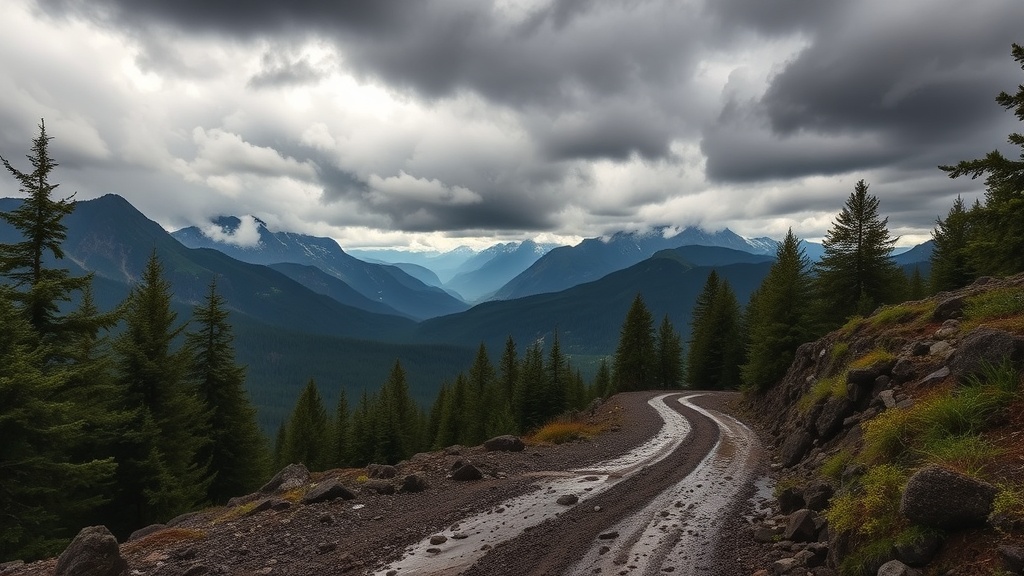
Heavy March rains have turned several beloved Cascades routes into soggy obstacles. If you’re planning a hike this weekend, you need real‑time info – otherwise you’ll waste miles on a dead‑end or, worse, end up stranded in a washout.
Which Cascades Trail Sections Are Currently Closed Due to Washouts?
Based on Washington State Parks alerts (updated March 13, 2026), the following segments are officially closed:
- Olallie Trail to Homestead Valley Trailhead – 0.8 mi of rugged forest road washed out by recent flash floods.
- Carter Creek campsite to the west side of the Snoqualmie Tunnel – debris field and eroded bridge foundations make crossing unsafe.
- Thorp Trailhead to Hwy 10 (central segment) – active maintenance crew clearing debris; expect rough surfaces and occasional road closures.
All other sections remain open but may have lingering mud and water‑logged rocks. Check the National Park Service trail conditions page for the latest updates.
How Can I Verify Real‑Time Trail Conditions Before I Head Out?
My go‑to workflow is a three‑step check:
- Visit the official Washington State Parks site and pull the latest "Trail Alerts" feed.
- Open the NPS trail‑conditions map for any park‑wide closures.
- Cross‑reference with my Cascades Permit Clock to see which permits are still valid for alternate routes.
If any of those sources list a washout, assume the trail is impassable until the park service posts a reopening notice.
What Detour Routes Should I Take to Bypass the Closed Segments?
Here are three vetted detours that keep you on solid ground while still delivering the Cascades experience:
- Detour A – From Olallie to Homestead via Deer Creek: Follow the Deer Creek fire road (approx. 1.2 mi) that runs parallel to the closed Olallie segment. It adds 0.5 mi but stays dry.
- Detour B – Carter Creek to Snoqualmie Tunnel via Old Logging Road: Use the historic logging road on the east side of the tunnel. The road is rough but passable with a sturdy pair of boots.
- Detour C – Thorp to Hwy 10 via the North Fork Trail: This side‑trail skirts the maintenance zone and offers a scenic viewpoint of the river valley.
All detours are marked on the updated Cascades trail map. Bring a GPS or printed map; the trailheads are easy to miss if you rely solely on cell service.
What Gear Should I Pack for Muddy Trail Conditions?
My Essential Gear for Day Hikes list already covers the basics, but add these two items for a washout‑heavy day:
- Water‑proof gaiters – keep mud out of your boots and protect your lower legs.
- Lightweight trekking pole set with mud‑spike tips – improves stability on slick rock and prevents you from slipping into hidden water channels.
Don’t forget a small quick‑dry towel to wipe off excess water before you reach camp.
How Do I Report New Washouts or Trail Issues?
If you encounter a fresh washout, log it immediately on the NPS "Report a Problem" form. Include GPS coordinates, a photo, and a brief description. I monitor those submissions nightly and forward critical alerts to the state parks liaison.
Takeaway: Stay Informed, Stay Safe, Stay on Trail
Spring rain will keep the Cascades messy, but with a quick three‑step check, a solid detour plan, and the right gear, you can still enjoy the season’s wild beauty without wasting a day. Bookmark this guide, set a daily alert on the parks’ trail‑alert RSS feed, and keep your boots mud‑ready.
Frequently Asked Questions
- When is the next update on trail closures? The state parks post updates every morning at 7 am PT. Refresh the page before you leave home.
- Can I hike the Palouse to Cascades Trail in March? Only the western segments are open; the central section remains closed until at least late April.
- What should I do if I encounter a washed‑out road with no detour sign? Turn back, log the issue on the NPS form, and use the nearest alternate fire road listed in the detour map.