Cascades Go/No-Go in 15 Minutes: My Pre-Dawn Safety Audit

Cascades Go/No-Go in 15 Minutes: My Pre-Dawn Safety Audit
If your "trail planning" is a screenshot from an app and a weather emoji, you are outsourcing safety to luck.
This is the exact 15-minute audit I run before wheels roll. It is built for shoulder-season Cascades hiking (roughly March through June), when one warm rain cycle can turn yesterday's "fine" route into today's SAR call.
I am not trying to optimize your summit photo. I am trying to keep you out of cold water, off closed roads, and out of a helicopter report.
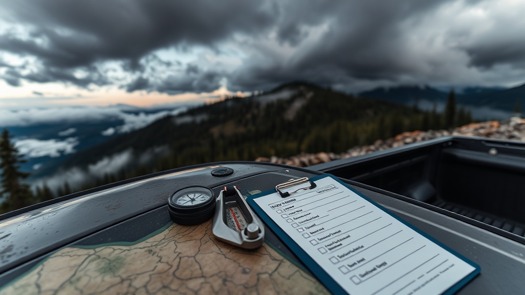
The 15-Minute Sequence
Minute 0-3: Point Forecast, Not City Forecast
Open NOAA's point forecast tool and pull weather for your actual route zone, not "Seattle" or "Bellingham."
- Trailhead point (parking elevation)
- High point (ridge/saddle)
- Turnaround point (where bad decisions usually start)
If those three points disagree on wind, precip, or temperature trend, you plan for the worst one.
Operational threshold I use:
>20 mphsustained wind above treeline: remove exposed ridges from the plan.- Freezing level near your route high point: expect mixed surface conditions and slower travel.
- Precip in forecast window plus overnight freeze-thaw: treat creek crossings as unstable.
Minute 4-6: Avalanche Bulletin Context
If your route touches avalanche terrain, check the Northwest Avalanche Center forecast before you touch your boots.
The North American Public Avalanche Danger Scale is 1 Low through 5 Extreme, and the danger rises nonlinearly between levels. It is also issued by elevation band, which is where people get sloppy.
Example of sloppy:
- "It says Moderate."
Useful interpretation:
- "It says Moderate at lower elevations and Considerable in the upper band where my route actually travels."
If you do not know which elevation band your slope exposure sits in, you are not ready for that route today.
Minute 7-9: Streamflow and Runoff Signal
Snowmelt season is where trail reports age out fast. I cross-check current streamflow conditions before any route with bridges out, fords, or known floodplain trail segments.
Washington Ecology maintains stream-gaging network links and near-real-time flow resources (including USGS sources). Use them.
My rule:
- If streamflow is running high for season and your route has mandatory crossings, downgrade objective or abort.
- If you cannot verify crossing conditions from a reliable same-week source, assume no-cross.
No hero points for "we'll figure it out at the creek."
Minute 10-12: Forest Alerts and Road Status
Mount Baker-Snoqualmie alerts are non-optional reading in shoulder season. As of March 2026, active notices have included hazardous conditions and road washout closures.
Look, this is where people burn hours and fuel because an app routed them to a closed approach road.
Check:
- Forest alerts/closures page
- Road and trail condition pages (district-specific when available)
- Last reliable report date (not just "someone on social said")
If approach access is uncertain, your route is uncertain. Treat it as a no-go unless you have a verified fallback.
Minute 13-15: Logistics Gate
Final gate before departure:
- Hard turnaround time written down
- Two check-in contacts with "call SAR at this time" instruction
- Offline map downloaded + paper backup
- Headlamp + shell + insulation packed even for day hike
If one item is missing, delay departure and fix it. No exceptions.
My Go/No-Go Matrix (Simple Version)
Use this as a quick decision table.
| Signal | Green | Yellow | Red |
|---|---|---|---|
| Forecast agreement (3 route points) | Similar trend across points | One major mismatch | Multiple mismatches |
| Avalanche context (if applicable) | Terrain/elevation fit is clear | Unclear elevation-band fit | You cannot map your terrain to bulletin bands |
| Streamflow/runoff | Normal and crossing intel recent | Rising with limited recent intel | High flow + mandatory crossings |
| Access and closures | Confirmed open approach | Partial uncertainty | Active closure/washout in access chain |
If you hit two yellows, downscope.
If you hit one red, cancel and pick a lower-consequence route.
Why This Works
Most incidents are not mystery events. They are stacked small misses:
- Wrong forecast location
- Ignored elevation-band hazard
- Outdated crossing assumptions
- Unverified road access
This 15-minute audit catches those misses before they become expensive.
Bottom Line
Stop calling it "being flexible" when it is actually bad pre-trip discipline.
A canceled route is a successful risk decision.
A completed route with clean margins is better than a sketchy summit with luck doing all the work.
If you want consistency in the Cascades, build a repeatable pre-dawn protocol and run it every time.
Sources
- NOAA National Weather Service, IDSS Forecast Points: https://www.weather.gov/forecastpoints
- Northwest Avalanche Center forecast portal: https://nwac.us/avalanche-forecast/
- Avalanche.org, North American Public Avalanche Danger Scale: https://avalanche.org/avalanche-encyclopedia/human/resources/north-american-public-avalanche-danger-scale/
- Washington Department of Ecology, Flow monitoring: https://ecology.wa.gov/research-data/monitoring-assessment/river-stream-monitoring/flow-monitoring
- Mount Baker-Snoqualmie National Forest, Alerts & Fire Danger Status: https://www.fs.usda.gov/detail/mbs/alerts-notices/?cid=stelprdb5126323