AI Hiking Tech Solves the Wrong Problem—Here's What Actually Works
Let's look at the data.
Spring break is here, and so is a new wave of "AI-powered hiking tools"—ChatGPT trip planners, route optimization plugins, apps that promise to make your next Cascades adventure smarter, safer, and more Instagrammable. I've spent the last few weeks looking at what these tools actually do versus what the search-and-rescue numbers actually show. The gap between those two things is significant—and in some cases, dangerous.
This isn't an anti-tech piece. I use technology on trail. But I came from ten years in logistics, where a $40,000 shipping container going to the wrong dock costs someone real money. You learn fast that the tools you trust need to be optimized for the right outcome—not the outcome that looks good in a demo.
Right now, a lot of hiking tech is optimized for the wrong outcome.
What AI Hiking Apps Are Actually Trained On
When you ask a hiking chatbot about a trail, it's drawing on a corpus of text. The question worth asking: what text?
AllTrails reviews. Reddit trip reports. Instagram captions. Tourism websites. Gear company blog posts. These are the data sources that are readily available, machine-readable, and abundant.
Here's what they systematically underreport: the hike that ended with a helicopter. The guy who turned back with hypothermia. The party of three that got separated and spent the night on a ridge. Near-misses don't get five-star reviews. They get silence—or if you're lucky, a comment buried under thirty "gorgeous views!" posts that says "trail is harder than rated, be careful."
SAR incident data tells a different story. I've spent time going through publicly available regional SAR reports—county SAR team annual summaries (King County SAR publishes these), USFS Pacific Northwest Region incident reports, and NPS injury data for Cascades-adjacent parks. No single source covers the full picture cleanly; the data is fragmented, published with lag, and categorized inconsistently across agencies. But the recurring contributing factors I see across these sources are consistent enough to be worth stating clearly:
- Overestimation of personal fitness relative to actual terrain
- Weather deterioration the party wasn't prepared for
- Inadequate water or food leading to impaired decision-making
- No communication device
- Poor turnaround discipline
I'm not presenting this as a peer-reviewed ranked list. I'm presenting it as the pattern I keep finding when I read the actual incident narratives—not the trail reviews. If a specific agency publishes a cleaner synthesis, I'll update this. But the pattern holds across what's publicly available.
Notice what's not in that pattern: not having the right trail app. Not lacking a "curated" route. Not failing to read enough reviews.
The AI tools flooding the market right now are trained to solve problems that don't actually cause most rescues. They're very good at answering "what's a scenic moderate hike near Bellingham"—which is approximately the wrong question.
The Hype/Reality Split: Engagement vs. Injury Prevention
Here's the core issue. Consumer tech is built around engagement metrics. More time in the app, more photos shared, more routes saved. These metrics are not correlated with safety outcomes—and in some cases, they're inversely correlated. That's my read; make of it what you will.
A trail recommendation algorithm that surfaces "most popular" routes in spring is surfacing routes that are popular when conditions are good. It has no mechanism to weight for seasonal hazard. Baker Lake in July gets the same algorithm treatment as Baker Lake in late March, when the road might still have snow and creek crossings are running high.
AI weather forecasting is the clearest example of this gap. Yes, commercial weather APIs have gotten better. But there's a structural difference between a regional precipitation probability and an elevation-specific mountain forecast. NWS mountain zone forecasts are built to model orographic effects—the way terrain forces air upward and compresses weather events into tight elevation bands. A commercial API pulling from lowland weather stations doesn't model this by default; it averages across a grid cell that might span from tidewater to 6,000 feet. That's not a knock on commercial weather engineering—it's a different product built for different use cases. The problem is when a hiking app labels their lowland-station API pull "AI-powered weather" and a hiker treats it as equivalent to the NWS zone forecast for a specific mountain range.
The NWS product is free. It's also ugly. So apps use the prettier API and market it as smarter. That's not a safety decision—it's a design decision that affects safety.
Your phone's step counter is another example. Several new "hiking fitness" apps are building hydration reminders off step data. The relationship between steps and sweat rate at elevation is not linear. Elevation, temperature, wind exposure, pack weight, and individual physiology all matter more than steps taken. A flat 10,000-step day at sea level and a 10,000-step day gaining 3,000 feet with a 30-pound pack are not comparable hydration events. This is not complicated math—it's just math the app doesn't do because steps are easy to count and everything else isn't.
What Actually Works (The Unglamorous List)
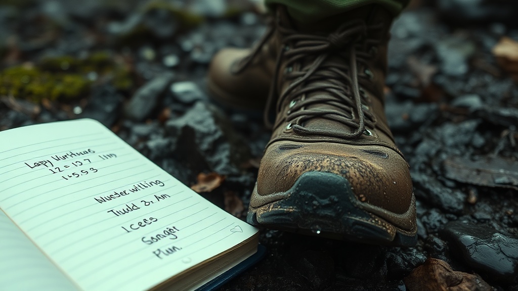
I've been hiking the Cascades seriously for nine years. I've documented every trip—entry time, exit time, weather conditions, party composition, water sources confirmed vs. expected, turnaround points. Logistics background. It's just how I think.
Here's what I actually carry and why:
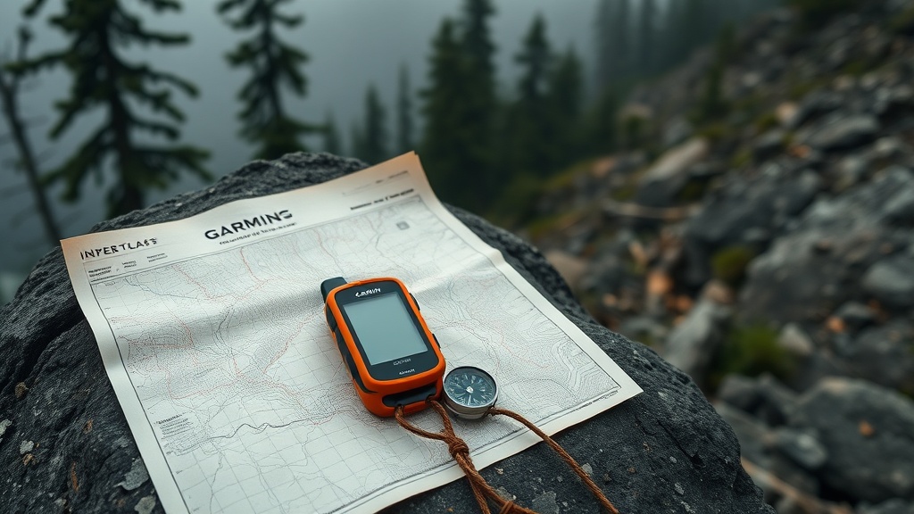
Garmin InReach Mini 2. This is the single piece of technology with documented correlation to survival outcomes in backcountry incidents. When you can summon SAR, the question becomes how fast they reach you—and that's mostly terrain and weather, not technology. But the difference between "lost with a communicator" and "lost without one" is stark in the data. Garmin has publicly documented over 10,000 SOS activations facilitated since InReach launched—a milestone they've reported in press releases. This device works when your phone doesn't, because it uses the Iridium satellite network, not cell towers.
NWS Mountain Weather Forecast. Free. Ugly interface. Built for elevation. I check the zone forecast for the specific mountain range, not the nearest town. I check it the night before and the morning of. I don't rely on in-app weather because I don't know what API they're using, how they're interpolating, or whether it accounts for orographic compression at the elevations I'm traveling.
Paper topo or downloaded offline map. Gaia GPS downloaded offline is fine. But I also have the paper 7.5-minute quad for anything technical. Paper doesn't need battery, doesn't need signal, doesn't crash.
Water filter + extra capacity beyond calculated need. I calculate water based on elevation gain, temperature, and duration. Then I add 20%. Water sources described as "reliable" in summer trip reports dry up or disappear under snowpack in shoulder seasons. I verify independently.
Turnaround time, written down. Before I leave the trailhead, I write a turnaround time on my trip plan. Not a turnaround distance. Time. Because distance remaining is irrelevant when you're behind schedule with daylight burning. The logistics brain is useful here: a delivery that won't arrive by the window doesn't get attempted. Same rule applies.
None of this is new. None of it requires AI. All of it addresses the contributing factors that actually show up in SAR incident reports.
Where the Money Is Going Instead
From what I can see in product launches and outdoor tech coverage this spring, investment is flowing toward:
- AI trail recommendation engines trained on review data
- Social sharing features built into GPS units
- Camera optimization for summit shots
- "Smart" poles and packs with sensors that generate data without clear safety application
- Subscription wellness features inside hiking apps
My assessment: these products are built to make the hike more shareable. Safety is often the marketing angle; it's not always the engineering objective. That's a legitimate product decision—I just think hikers deserve to know the distinction.
The Garmin InReach—the device with actual documented rescue outcomes—is not the trendy product. It's not optimized for sharing. It's a chunky orange rectangle that sends an SOS. It's been around for years. It's not getting the spring launch coverage.
What Would Actually Reduce Injuries
If I were staffing an R&D team focused on injury prevention—not engagement—here's what I'd build:
Real-time SAR incident reporting network. Right now, SAR data is collected regionally and published with significant lag, often annually. A near-real-time layer showing recent incidents by trailhead and trail segment would let hikers and land managers identify emerging hazards fast. This exists in avalanche forecasting (avalanche.org is a functional model). It doesn't exist for general backcountry hiking at any useful granularity.
Standardized trail difficulty ratings with objective inputs. "Moderate" is meaningless. Vertical gain per mile, maximum grade percentage, technical terrain classification (Class 1–5), and seasonal condition overlays are not. The data exists. Agencies have it. No one has built a standard that app developers are required to use. This is a policy problem as much as a tech problem—but tech could lead here.
Trailhead congestion data with permit integration. Crowded trailheads lead to parking lot incidents, trail degradation, and—critically—overextended parties who assume "this many people are doing it, it must be fine." Real-time trailhead counts linked to permit systems and historical incident data would help land managers communicate risk dynamically. A few pilot programs exist. None are scaled.
Actual elevation-based hydration calculation. Not step counting. Elevation gain, temperature, pack weight, duration. The formula isn't complicated. No one has built it into a mainstream app because the inputs require more work than a step counter provides.
Weather decision trees, not weather data. Don't show me 74% precipitation probability. Show me: "At your planned summit time, forecast conditions are X. Based on historical incident data for this trail in these conditions, SAR call frequency is Y." That's a decision support tool. What we have now is a weather widget with a machine-learning label.
The Bottom Line
The spring hiking AI boom is real. The safety claims attached to it are, in my judgment, mostly marketing. This isn't cynicism—it's a systems read from someone who spent a decade optimizing for outcomes, not optics.
If you want to reduce your probability of becoming a SAR statistic this spring, the pattern in available incident data points to a short list: carry a satellite communicator, check NWS mountain zone forecasts (not just app weather), establish a turnaround time before you leave the trailhead, and calibrate your water beyond what the reviews say.
The AI trip planner can help you pick a trail. It cannot tell you whether you're ready for it, what the creek crossing looks like right now, or whether the party in front of you turned back for a reason.
That judgment is still yours to make. Make it with the right data.
Stay safe. Use the tools that actually work.
Garrett Vance is a former logistics manager turned Cascades trail analyst based in Bellingham, WA. He documents trail conditions, permit logistics, and safety data for hikers who want honest information about Pacific Northwest terrain.