8 Early-Season Trail Questions Before You Hike the Cascades

This list covers the checks that keep an early-season Cascades day hike from turning into a sloppy retreat, a cold river problem, or a call for help after dark. What matters is what's on the route today—how much snow remains above the trailhead, whether the creek is still tame in the afternoon, and whether the access road is open at all. If you ask these eight questions before leaving the car, your plan gets a lot more honest.
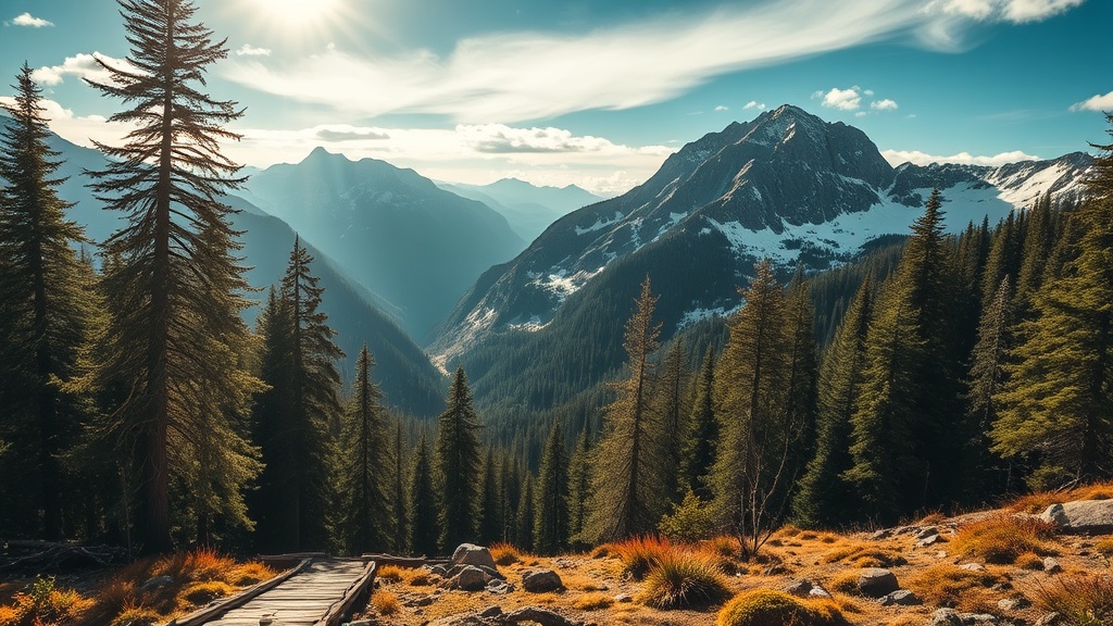
1. What does 'snow free at the trailhead' actually tell you?
Less than most hikers think. A thawed parking lot only tells you the first few hundred vertical feet are clear enough to stand on. In the Cascades, north-facing timber, shaded gullies, and long traverses can hold firm snow well above a dry start. That's why a trail that looks friendly for the first mile can turn into route-finding work after the second switchback.
Read the trail profile, not just the headline condition. Look for where the route crosses 4,000 feet, turns to the north side of a ridge, or enters steep tree cover. Land manager condition pages, including updates like the Mount Rainier trail and backcountry conditions page, often note where continuous snow begins. If the last solid update says snow starts at 4,500 feet and your objective tops out at 5,800, you are not hiking a summer trail. You're hiking a partly buried line that will probably erase tread, hide junctions, and slow you far more than the mileage suggests.
2. Can you trust a trip report from last weekend?
Only if you read it like a condition report, not like a postcard. The date matters, but so do the overnight lows, the afternoon highs, and how far the writer actually went. A report that says conditions were manageable means very little if the party turned around before the snowfield, crossed the creek at 8 a.m., or posted after a colder weather window than the one you're walking into.
Look for three details: elevation reached, time of day at the problem spots, and photos that show the surface instead of just the view. A boot track that looked tidy on Saturday morning can turn into calf-deep postholing by Sunday afternoon. A log crossing that felt stable before runoff spikes can be half underwater two days later. If a report leaves out the boring parts, fill the gap with a conservative assumption.
3. How do you judge a creek crossing before runoff peaks?
Start with the season, then the clock. In spring, crossings that look harmless on a map can become the most serious hazard on the whole outing because snowmelt stacks volume through the day. A shin-deep crossing at 8 a.m. can push toward the knee by early afternoon, and cold, fast water does not need to be deep to knock someone sideways.
When you reach the bank, stop and watch the water for a full minute. Is it carrying debris? Is it undercutting the edge? Is the log people have been using actually dry enough to trust, or is it polished slick? If you can't see a clean entry and exit, the crossing is already talking back. So is a braided stream where one bad step drops you into the main current. Early in the day you may have options. Late in the day, after more melt and more fatigue, the same crossing can close behind you. Think about the return trip before you commit to the outbound one.
4. What happens when the trail crosses old avalanche paths?
It stops behaving like an ordinary trail. Old debris fields can look settled from a distance, yet still hide voids between tree trunks, hard runnels that trip your feet, and steep snow tongues with ugly fall lines below. That's where hikers get fooled by tracks. One boot path across dirty snow doesn't prove the slope is mellow enough for your group, your timing, or your margin for error.
Before a trip that crosses avalanche terrain, check the Northwest Avalanche Center and pay attention to whether wet loose slides, glide cracks, or warming trends are still in play. Then compare that to the route shape. If the trail crosses beneath open gullies or broad bowls, don't shrug off lingering snow just because you aren't skiing. On foot, you move slower, you spend longer under exposure, and you often don't have the tools to arrest a slide on steep spring snow. If a crossing would punish a slip with a long ride into rock, timber, or a creek bed, that section deserves a much harsher rating than the guidebook headline.
5. How much slower will you move once the trail disappears under snow?
Usually much slower than your app predicts. Dry-trail pace dies fast when you lose tread, bury the switchbacks, and start searching for the route every few minutes. Even well-packed snow adds friction because every decision takes longer: where to traverse, whether that depression is the real trail corridor, whether the track ahead belongs to someone who knew what they were doing or just wandered confidently into the wrong basin.
A good planning rule is simple: once you expect patchy to continuous snow, stop using your summer pace as the anchor. Build extra time for route checks, short stops, and the fact that descent may not be much quicker if the surface softens. This is where hikers talk themselves into trouble because the summit looks close on the map. It may be close in distance and still an hour away in movement. If your return depends on moving faster later, you don't have a plan; you have a hope dressed up as one.
6. Which road and weather details can wreck a solid plan before sunrise?
Plenty of them. In shoulder season, the hike may be fine while the road is gated, washed out, or blocked by a lingering snow berm that adds miles before you even shoulder the pack. Weather can do the same thing in quieter ways. A valley forecast of mild temperatures tells you almost nothing about wind on an exposed ridge, overnight refreeze above 5,000 feet, or whether cloud cover will flatten visibility on a snow-covered slope.
Check the road status from the managing agency and pull a point forecast from NOAA for the actual elevation band near your route, not just the nearest town. Then ask two blunt questions: if the road is closed earlier than expected, is the longer approach still worth it, and if the ridge is in cloud, do you still have a route you can follow cleanly? Small access errors stack into late starts, rushed decisions, and people forcing bad terrain because they feel behind before the hike even begins.
7. What gear earns its weight when the trail shifts between mud, ice, and sun?
This is where restraint matters. You don't need to drag half the garage uphill, but you do need gear that matches mixed surfaces instead of a single photo from the route page. Trekking poles matter because they buy balance on stream banks, snow patches, and sloppy descents. Foot traction matters when morning crust turns a short traverse into a slip hazard. A dry pair of socks and a simple waterproof layer matter because soaked feet and a cold breeze can turn a minor delay into a morale collapse.
Carry map navigation you can read without service, plus enough food and water margin to absorb a slower day. If you're debating whether to bring traction because the route is mostly melted out, remember that one steep frozen patch can control the whole outing.
8. When should you turn around even if the summit is close?
Turn around when the route starts collecting penalties faster than you're clearing them. That usually shows up in three ways: the snow is softening enough that every step costs more than expected, the creek you must cross on the way back is clearly rising, or your group is missing time marks you set while everyone was still fresh. None of those problems improve because the high point is near.
Set a turnaround time before you leave the trailhead and treat it as a rule, not a mood. Do the same for one or two terrain triggers: maybe it's the first crossing you can't reverse confidently, maybe it's the first steep snow traverse without a safe runout, maybe it's the moment cloud cover erases the route corridor. Getting turned around 300 feet below the top stings for ten minutes. Needing help in fading light can stain the rest of your season.