7 Trail Signs That Reveal What You're Really Getting Into

Most hikers glance at trail markers without a second thought—assuming that a maintained path means a safe path. That's a dangerous assumption in the Cascades, where conditions shift hourly and official ratings rarely tell the full story. Over the years, I've watched confident day-hikers turn around on what should have been easy loops, while others barrel into exposed scrambles they weren't equipped to handle.
The difference? Knowing how to read the subtle signals embedded in trail markers, terrain, and vegetation. These indicators don't lie—and once you learn to spot them, you'll make better decisions before committing to a route that could strand you above tree line or send you down a slope you can't climb back up.
Here's what experienced Cascade hikers look for before taking another step.
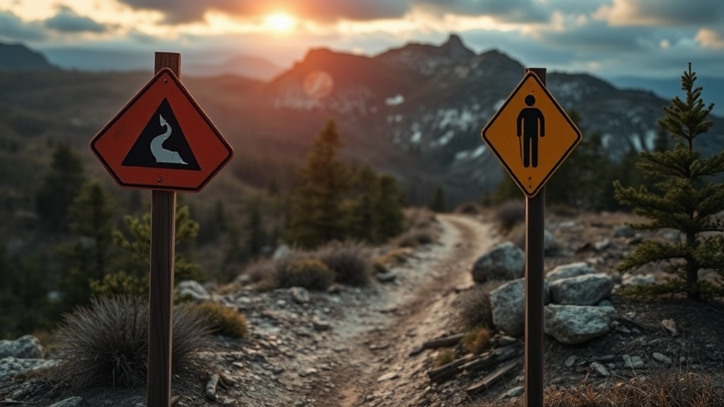
What Do Weathered Trail Markers Actually Tell You?
Faded blazes and worn cairns aren't just signs of neglect—they're warnings about what lies ahead. In the Pacific Northwest, where rainfall averages 150+ inches annually in some watersheds, maintenance crews face impossible backlogs. A trail that hasn't seen fresh paint in three years likely hasn't seen brush clearing either.
Look at the marker itself. Is it freshly painted or sun-bleached to near-invisibility? Are the aluminum tags still legible, or has the acid rain etched them smooth? Fresh markers suggest regular patrols and cleared blowdown. Faded ones often precede miles of overgrown trail where you'll be bushwhacking through slide alder and fighting devil's club.
The Pacific Northwest Research Station tracks trail maintenance frequency across National Forest lands, and their data confirms what field observation suggests: trails with markers older than five years see 60% more reported incidents involving route-finding errors.
Why Does the Trail Surface Change Mid-Route?
You start on packed dirt—well-graded, obvious, forgiving underfoot. Then suddenly you're on loose scree, or the tread disappears into a boulder field. That transition isn't random; it's a boundary.
In the Cascades, maintained trail typically ends where the budget ends—or where the terrain becomes too unstable to justify the labor cost. When you hit cobble-sized loose rock, you're often crossing onto unmaintained climber's paths or historic routes that haven't seen a crew in decades. The Forest Service doesn't always mark this transition clearly, and apps like AllTrails frequently don't distinguish between maintained tread and social trails.
Watch for these surface shifts:
- Compacted dirt → loose gravel (maintenance ends)
- Cut tread → braided multiple paths (user-created confusion)
- Stable rock → talus or scree (exposure and injury risk increase)
- Duff-covered ground → exposed mineral soil (heavy erosion, poor drainage)
If you spot multiple parallel trails braiding across a slope, you're not on official tread anymore—you're following whatever path previous hikers happened to take. These social trails often lead to dead ends, cliff bands, or dangerous stream crossings that the real route avoids.
How Can Tree Damage Reveal Avalanche Risk?
Bent, broken, or abruptly missing trees tell stories that snow science reports sometimes miss. When you're hiking below 5,000 feet in spring or early summer, look up at the tree line on adjacent slopes. Flagged trees—branches sheared off on the uphill side—indicate regular avalanche activity.
Even in July, snowfields above you can release wet slides during afternoon warming. If you see a swath of snapped trunks, leaning timber, or debris piles at the base of steep slopes, you're in an active avalanche path. The American Avalanche Association classifies these terrain traps as zones requiring specific timing and gear considerations, not just casual afternoon hiking.
Other vegetation signals to note:
- Stunted, wind-sculpted krummholz near ridges (exposure to severe weather)
- Sudden transitions from forest to meadow without obvious cause (historical slide paths)
- Young, even-aged tree stands replacing mature forest (past catastrophic events)
These patterns develop over decades. They're not in the guidebook—but they're in the landscape, plain as day, if you know what to look for.
What Do Water Stains on Rocks Indicate About Creek Crossings?
You reach a creek crossing. The current looks manageable. But before you commit, study the rocks.
High-water marks—dark staining, debris lines, or algae growth well above current flow—reveal how much higher this water runs during peak snowmelt or storm events. If you're seeing fresh, unweathered scars on boulders or freshly deposited logs jammed mid-stream, that creek has been running much higher recently.
The Cascades experience dramatic diurnal flow cycles. A creek that's ankle-deep at 7 AM can become waist-deep by 3 PM on warm days. Those water stains are historical data—evidence of what happens when the sun hits the snowfields above you.
Look downstream, too. If the channel narrows into a gorge or slot canyon, any mistake at the crossing becomes unrecoverable. The National Park Service stream-crossing guidelines emphasize that the consequences of a fall matter as much as the difficulty of the crossing itself.
Why Should You Distrust Cairns in Certain Terrain?
Rock cairns serve as route markers above tree line and across scree fields. But not all cairns are official—and some are actively dangerous.
In the Cascades, well-meaning hikers frequently build cairns that lead nowhere, or worse, that direct traffic onto unstable terrain or away from safer routes. If you're following cairns and the travel becomes increasingly exposed, technical, or loose underfoot, stop and reassess. Official cairns typically follow the path of least resistance, not the most dramatic line.
Indicators of questionable cairns:
- Inconsistent construction style (some large, some tiny, different rock types)
- Placement on exposed edges rather than safe passage lines
- Leading toward summit scrambles when the trail should traverse
- Appearing in areas with clear, maintained tread nearby
When in doubt, look for the subtle signs of heavy traffic: worn rock, boot polish on stone, compacted dust in flat spots. Cairns should reinforce obvious travel paths, not create them from scratch.
How Do Wildlife Trails Differ from Human Trails?
Game trails can look surprisingly like hiking paths—especially in areas with heavy elk or mountain goat traffic. But following the wrong trail can deposit you on a cliff ledge, in thick brush, or miles from your intended route.
Wildlife trails typically:
- Follow the fall line directly rather than switchbacking
- Thread through dense vegetation that hikers would avoid
- Show narrower tread width and different hoof/print patterns
- Lead to water sources, mineral licks, or bedding areas rather than passes
In the Alpine Lakes Wilderness and Glacier Peak areas, I've seen hikers lose hours following elk trails that parallel—but never quite connect with—the actual hiking route. The giveaway is often the trail's obsession with efficiency: animals take the shortest path, while human engineers build for sustainability.
If your "trail" suddenly dives into slide alder, crosses a creek without a log bridge, or becomes too narrow for two feet side-by-side, you've likely diverged onto game travel.
What Do Abandoned Structures and Debris Reveal About Stability?
Old bridges, rotting signposts, rusted cable remnants—these aren't just historical curiosities. They're warnings about changing conditions.
A collapsed bridge means the drainage it crossed has shifted, either through erosion or debris flow. The Forest Service didn't abandon it randomly; repairs were likely deemed unsafe or impractical. When you encounter remnants of past infrastructure, ask what forced the abandonment. Usually it's one of three things: landslide activity, flood damage, or hazard trees that made maintenance too dangerous.
Similarly, old mining debris, cable systems, or collapsed structures indicate unstable geology. The Cascades host plenty of volcanic and glacially over-steepened terrain. Human works don't last long where the ground moves.
These artifacts also signal that you're on a historic route that may not appear on modern maps. Navigation gets harder when the trail you're following hasn't been maintained since the 1960s and doesn't match your GPS track.
Putting It Together: Reading the Route Before You Commit
No single indicator tells the whole story. The competent Cascade hiker synthesizes multiple signals: Are the markers fresh AND the tread well-defined AND the vegetation appropriate for the elevation? Or are you seeing faded blazes, braided social trails, and game paths that don't quite align?
Trust the cumulative evidence. When three or more warning signs stack up—weathered markers, surface transitions, avalanche-flagged trees, questionable cairns—it's time to reevaluate your plan. Turnaround decisions should happen before you're committed above exposure or beyond your skill level.
The mountains will be there tomorrow. Making sure you're around to hike them means reading the signs that matter—and respecting what they tell you.